
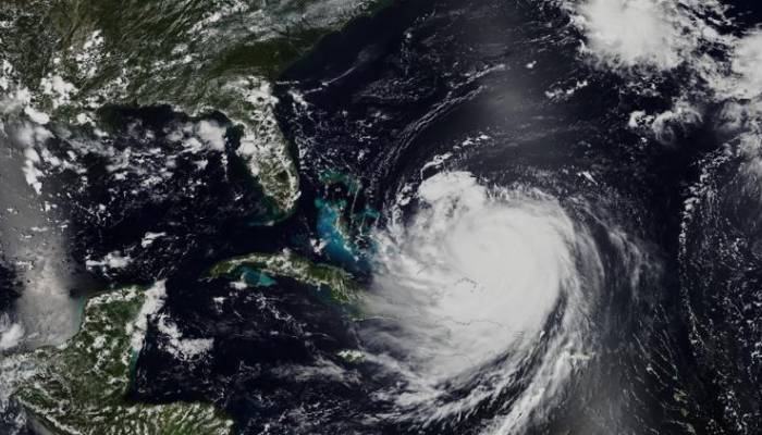
Hurricane Erin changed its path unexpectedly and is heading towards the US East Coast with Category 2 strength.
After hitting the Caribbean with 130 mph winds and heavy rain that caused widespread power outages in Puerto Rico, there are growing concerns that Erin could strike the US as a Category 2 hurricane this week.
As per The Independent, the National Hurricane Center said the storm is expected to turn northwest into open waters and is unlikely to hit the US directly.
Meanwhile, authorities has issued multiple warnings about hazardous surf and rip currents for the US, Bahamas, Bermuda and Atlantic Canada this week.
By 5am ET, Hurricane Erin's wind had dropped to 100mph and the storm was located about 455 miles south-southeast of North Carolina's coast.
Starting Wednesday, the North Carolina Outer Banks were expected to face flooding from storm surges, strong winds and heavy rain with 4-foot waves spilling over sea walls, making the situation even more worse.
While, Virginia’s southeastern coast and Bermuda could face tropical storm conditions on Thursday and strong winds are expected from Thursday to Saturday along the Mid-Atlantic, Southern New England and Atlantic Canada.
The hurricane is forecasted to expand with tropical-storm-strength winds reaching 265 miles from its center before starting to weaken by Friday.


