Heavy rains and flooding are expected across south-east England from Thursday, August 28.
The Met Office has issued yellow weather alert which will start at 10:00 pm BST and ends at noon on Friday, August 29.
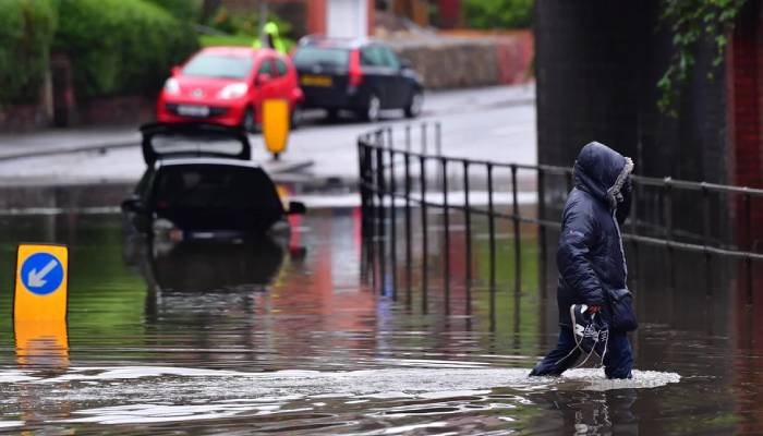
These warnings applies to Kent, Sussex and Surrey that could disrupt transport and damage infrastructure.
The statement added, "Whilst not everywhere will see the heavy showers or rain, where they do occur 10-20 mm of rain in less than an hour is possible," as per BBC.
"50-70 mm of rain is possible in a few hours where heavy showers become more prolonged, this most likely near coasts," it further revealed.
The Met Office further noted that the bus and train services will probably be delayed and roads may be slower due to water and flooding.
This heavy rain warning comes at the end of summer that has experienced four heatwaves across many parts of Britain.
The Met Office has recently suggested that the UK has probably had its hottest summer on record.
While, new records of temperatures were set on this August bank holiday Monday with Hawarden reaching 29.1C and Gogerddan 28.1C, breaking the previous record of 26.5C from 1991.
Beside this, the summer's highest temperature was 35.8C recorded in Faversham, Kent on July 1.