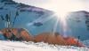
Amid rising temperatures around the world, parts of the northern Rocky Mountains are expected to face heavy snow, strong winds and colder temperatures, with authorities warning against any travel plans.
The National Weather Service has issued a winter storm warning and winter weather advisory for the regions where Idaho, Montana and Wyoming border each other.
As an intense heatwave engulfs Europe and much of the globe, the US region has received a fresh winter warning just ahead of the 250th anniversary of the United States as residents prepare for the 4th of July celebrations.
Travel restrictions amid winter storm warning
Authorities have urged residents to not travel across the backcountry this weekend and during the start of the next week.
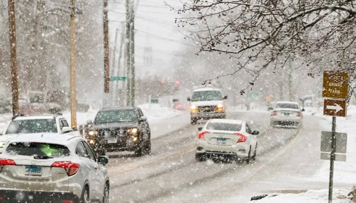
"Persons should consider delaying travel across the backcountry and higher elevations. If travel is absolutely necessary, consider taking a winter storm kit along with you, including such items as tire chains, booster cables, [a] flashlight, [a] shovel, blankets and extra clothing," the National Weather Service said.
They added, "Also take water, a first aid kit, and anything else that would help you survive in case you become stranded."
The alert is for the high country around Salmon, the Bitterroot, and the Sapphire ranges, and the storm is being driven by a cold Pacific trough into the Rockies and Intermountain West, dropping snow levels to roughly 6,500 feet just days before July.
3 feet of snow expected
Specific regions in Montana are expected to see "heavy, wet" snow, and the Georgetown Lake region could see as much as three feet of snow from Saturday night through Tuesday.
"Plan for winter-like conditions in the backcountry and higher elevations. Cold temperatures, wind, and wet snow will elevate the risk of hypothermia. Heavy wet snow may down trees, blocking access to backcountry roadways," a warning from the National Weather Service read.
Moreover, 4th of July Peak in Idaho is expected to see around a foot of snow over the next three days, with Pitchstone Plateau facing the most snowfall in Wyoming, with eight inches coming over the next few days.
Along the border of Montana and Wyoming near the Beartooth Mountains, the snow will lighten or even stop for a time Sunday afternoon into Sunday evening.
Snow will redevelop Sunday night and continue into Monday and Tuesday morning.
Intense cold temperatures in the region
Temperatures across western Montana and central Idaho are falling 20 to 30 degrees from late-week summer warmth, with valley highs dropping into the 40s and 50s and freezing levels collapsing onto the peaks.
Region braces for strong winds
Besides heavy snowfall, the region is also expected to face extremely windy conditions amid storm warnings.
“Strong winds develop across portions of north-central MT this afternoon/evening around a low pressure center meandering around the International Border. Wind speeds are likely to peak early this evening with a few gusts in excess of 50 mph causing difficult cross-winds,” the Great Falls office said.
Campers receive stern warning ahead of storm
Campers in the region received a severe warning ahead of the winter storm, as the NWS highlighted the possible risks of outside activities in this specific weather.
A warning from the National Weather Service read, "Campers should be aware that it only takes a few inches of snow to damage tents and other recreational items."
The winter storm warnings and winter weather advisories run through Monday night.