A Google Street View image helped to solve a murder case in a northern Spanish town.
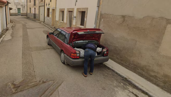
According to BBC, police said that Google Street View showed an image of a man loading a white plastic bag into the boot of his car. Another blurred image showed a person transporting the bag on wheels and a borrow. The officials asserted that the images served as a crucial clue in the case.
Moreover, police also highlighted the role of Google Maps in helping the investigation, saying it was "one of the clues that investigators had to use to solve the crime." Adding that the footage helped to “detect a vehicle that could have been used in the course of the crime."

Two suspects were arrested in November after the Google app captured the exact moments when the body of the victim was removed from the scene.
The two arrested are accused of the disappearance and murder of a man in October 2023 whose remains were found in a cemetery in a town in Soria last week.
Furthermore, a 33-year-old Cuban national went missing last October after his relative received a suspicious text from his phone, saying he had met a woman, was leaving Spain, and would get rid of his phone.
Notably, Google Maps shows pictures of the worldwide streets taken by cars with cameras, and this was the first time in 15 years that a Google camera car visited the town of Tajueco in Soria.


