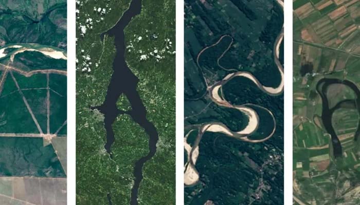
NASA has introduced an exciting update that enables users to type their name into a search bar and see it spelled out in natural formations on Earth as viewed from outer space, courtesy of data from NASA's Landsat satellites.
According to NASA, "With each new launch, Landsat’s decades-long data record becomes even more valuable. As the longest continuous space-based record of Earth’s surface, Landsat offers a unique resource to scientists studying long-term changes."
"Researchers have used Landsat’s archive to study how cities have grown, coastlines have shifted, crop cycles have changed, and forests have transformed since the 1970s," NASA added.
How to use NASA's Landsat images?
To use this intriguing feature, initially visit the "Your Name in Landsat," interactive tool on NASA's website.
Insert your name into the text bar, showing “enter a name,” and tap enter to view results.
The website will later show the landforms that correspond to the letters in your name to offer location whether they are available in latitude and longitude and by name.
Notably, NASA’s engaging feature uses landsat photos from the NASA Earth Observatory, NASA Worldview, USGS EarthExplorer and ESA Sentinel Hub, as per NASA.