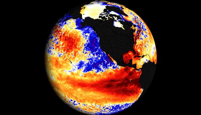
El Niño is emerging even faster than expected in the Pacific Ocean and odds are increasing that it could become historically strong, a rare “Super” El Niño, by fall or winter.
This is according to a just-released update from NOAA’s Climate Prediction Center that says there is a 2 in 3 chance that El Niño’s peak strength will be strong or very strong.
El Niño is a natural climate cycle that happens when the tropical Pacific Ocean warms enough to trigger shifts in wind patterns throughout the atmosphere, which has a ripple effect on weather conditions worldwide.
Droughts and heat waves can flourish in some regions, fueling wildfire danger and water supply concerns, while others are swamped by flooding rainfall.
El Niño’s far-reaching effects can also stymie the Atlantic hurricane season. On a larger scale, it causes already rising global temperatures from human-caused climate change to spike even higher. Stronger El Niños make all these impacts more likely.
El Niño occurs about every two to seven years and lasts nine to 12 months.
Its strength is measured by how far water temperatures rise above average in a patch of the equatorial Pacific Ocean, and it usually peaks in the Northern Hemisphere’s winter.