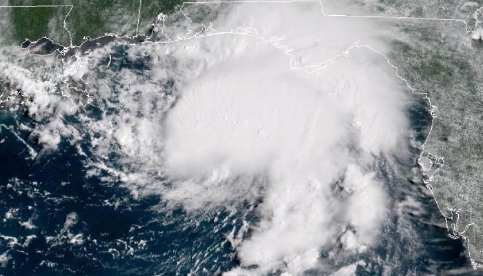
Tropical Storm Gordon formed in the eastern Atlantic on Friday morning, September 13, as the National Hurricane Center (NHC) monitors several weather systems in the Atlantic Basin this week.
Now entering the peak of hurricane season, Gordon, previously Tropical Depression Seven, gained enough strength to become a tropical storm.
The NHC's latest update places Gordon around 1,000 miles from the Cabo Verde Islands, with maximum sustained winds of 40 mph, as per The NewYork Times.
The storm is expected to stay over open waters for the next several days, moving slowly west-northwest.
The NHC noted that the storm is forecasted to remain a tropical cyclone and could strengthen further in a few days as it enters more favourable conditions.
However, at this time, there is no anticipated impact on the US.
Additionally, the NHC mentioned that a low-pressure system could form off the southeastern US coast in the coming days.
At the moment, meteorologists are calling this a "fish storm," as it remains in the Atlantic and is likely to only impact the ocean, leaving land unaffected.
While, there is a small chance of subtropical or tropical development early next week, the chances remain low over the next seven days.