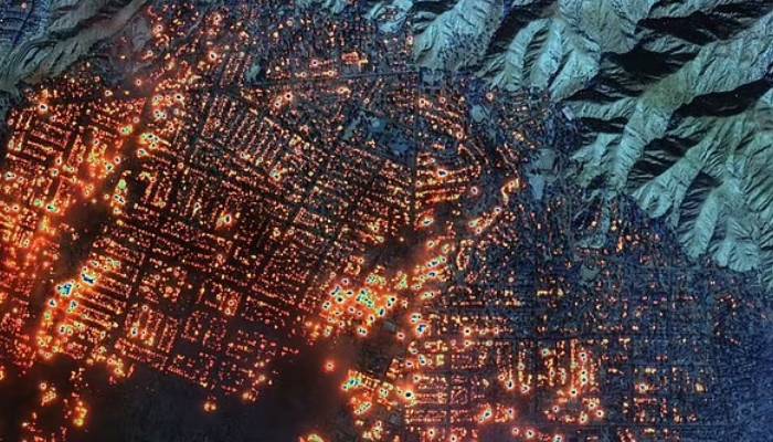
The ongoing wildfires in Los Angeles have caused massive destruction, leaving thousands of people homeless.
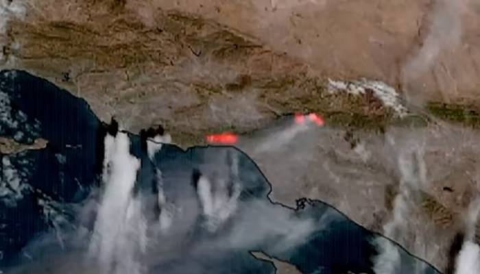
Meanwhile, satellite images revealed shocking details about the extent of the fires and how quickly they spread.
On the morning of January 7, severe drought conditions and strong winds, reaching up to 100 miles per hour, contribute to the spread of wildfires in the wealthy Los Angeles neighbourhood of Palisades.
Since the wildfire began, at least five people have lost their lives, thousands of home have been destroyed and more than 130,000 people have been forced to leave their homes to stay safe.
Satellite images taken by a group of satellites in orbit show surprising yet alarming pictures of how the fire expanded rapidly, covering more than 27,000 acres in just three days, as per Daily Mail.
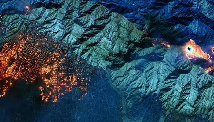
When the fire began on Tuesday, the European Space Agency’s Sentinel-2 satellite detected smoke rising over the Pacific Ocean.
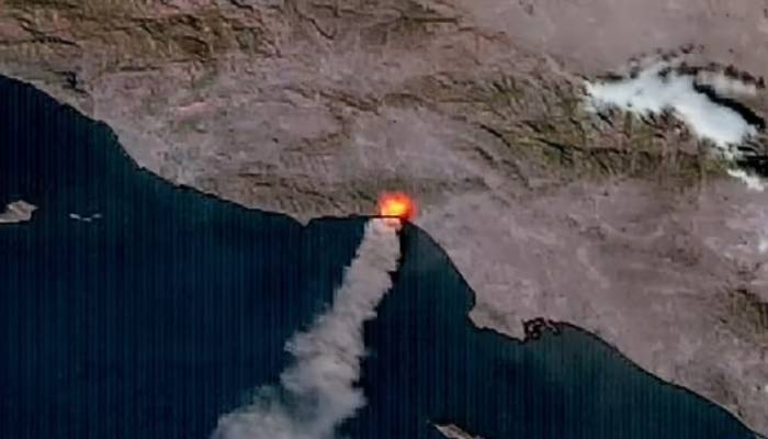
A few hours later, NASA’s Aqua satellite captured images showing how the fire had already spread into the narrow streets of the Pacific Palisades neighbourhood.
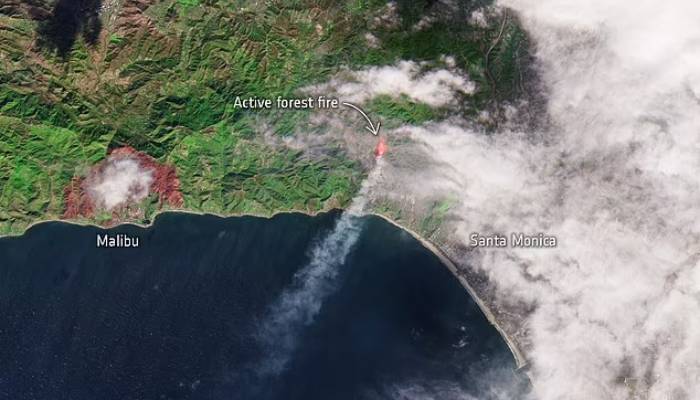
The satellite camera captures images showing that the fire began as a forest fire in a wooded area located just to the west of Santa Monica.
The National Guard has been deployed and sent to help with the situation and may send military personnel to help with the crisis.
Santa Ana winds are a seasonal weather event that happens every year between October and January.
These winds are caused by a difference in air pressure between the Great Basin and the cooler Pacific Ocean, which results in high wind speeds.


