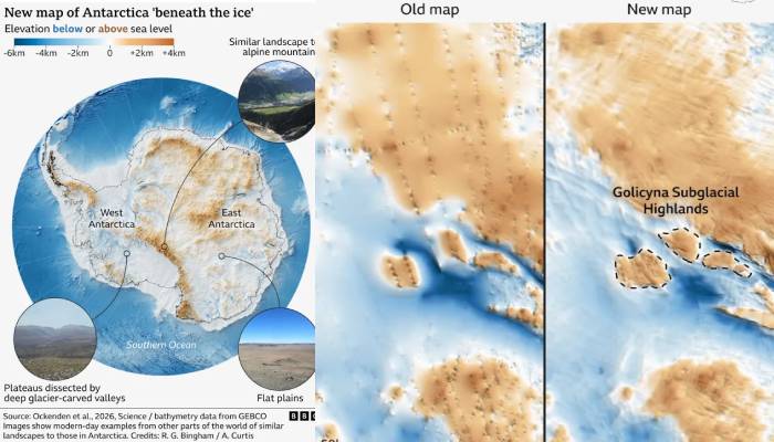
Scientists have remarkably devised the most detailed map ever of the land underneath Antartica's massive ice sheet.
Researchers used satellite data with knowledge of how glaciers move to estimate the shape and features of the land hidden beneath the ice.
The map reveals a rich landscape of mountains, canyons, valleys and plains and tens of thousands of smaller features like hills.
A study published this week in the journal Science suggested that this map can help predict how Antarctica will respond to climate change and what impact this could have on rising sea levels.
Glaciologist Robert Bingham of the University of Edinburgh in Scotland, who helped lead the study said in a statement, noting, "Having the most accurate map of Antarctica's bed shape is crucial."
He added, "Because the shape of the bed is an important control on friction acting against ice flow, which in turn we need to include in numerical models that are used to project how rapidly Antarctica's ice will flow towards the ocean, melt and contribute to global sea-level rise."
Antarctica is about 40% larger than Europe, 50% larger than the United States and roughly half the area of Africa.