
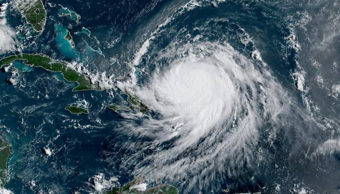
Hurricane Erin has strengthened to a Category 4 hurricane and is expected to create deadly sea conditions like powerful waves and rip currents along the eastern coast of the United States.
Heavy rains from the storm have already started affecting the southeastern Bahamas and the Turks and Caicos Island.
Because of the danger, authorities have issued a tropic storm warning there to alert people of possible strong winds, heavy rainfall and rough seas.
The country's Disaster Risk Management Authority said that "these storms are very volatile and can make sudden shifts in movement."
Erin, which is the Atlantic’s first major hurricane of the season will not directly strike the islands but it will still cause heavy rain there.
It suddenly became extremely powerful as a Category 5 storm on Saturday, then weakened for a short time but is now becoming strong again.
Forecasters expect Hurricane Erin's center to pass east of the southeastern Bahamas today and then move between Bermuda and the US East Coast around midweek.
They also warned that Erin will still stay very strong and dangerous during this period.
On the other hand, Outer Banks in North Carolina are preparing for strong waves and winds from the storm.
Considering this, officials have asked everyone on Hatteras Island to evacuate as the main road connecting it to other islands might get blocked or flooded.


